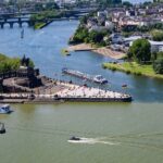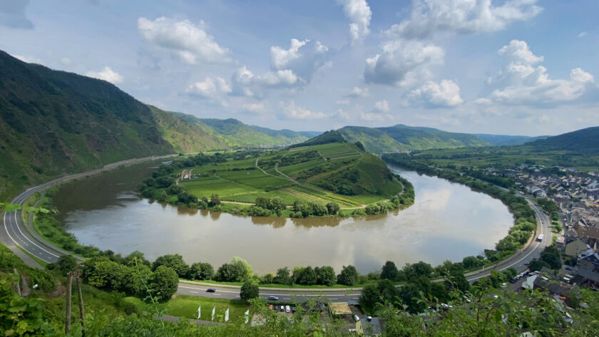
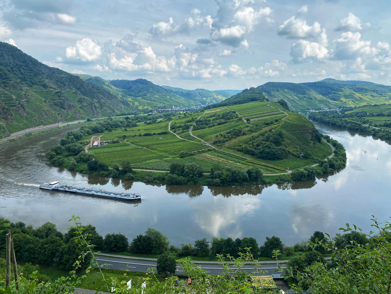
The horseshoe bend in Calmont is one of the most beautiful spectacles of the Mosel River, attracting visitors from all around to witness this stunning natural occurrence. A horseshoe bend occurs when a river makes a sharp, U-shaped curve, creating a nearly circular loop. Such a horseshoe bend is prominently visible from Bremmer Calmont in the Mosel region. Another such occurrence is seen in the Rhine river from Vierseenblick Boppard.
Hiking to Bremmer Calmont is a relatively short but highly rewarding experience, offering natural exposure, a moderate ascent, and the magnificent view of the Mosel River’s horseshoe bend. This beginner-level hike is suitable for people of all ages. The trail takes you along narrow paths, with several viewpoints along the way where you can take in the serene beauty of the Mosel River, along with the surrounding towns and landscapes.
Important Details of the Hike to Bremmer Calmont
| Hike duration | 2 hours |
| Hike start and end | Ascend from Ediger-Eller and descend to Bremm |
| Distance | 5.5 kilometers |
| Hike type | Beginner |
| Requirements | Good hiking shoe Sure-footedness |
| Challenge | Narrow hiking trails |
Getting to Ediger-Eller
Public transport is the easiest way to reach Ediger-Eller and explore the Bremmer Calmont area. The RB 81 train runs regularly to Ediger-Eller every hour from Koblenz. Alternatively, you can take the RE 1 train and get off at Bullay. From Bullay, you can catch the 710 bus (heading towards Cochem) to Ediger-Eller Bahnhof.
The Deutschland Ticket is valid for regional trains and buses, making it a convenient option for this journey. Below are the travel times from nearby cities, allowing for a same-day return trip.
| From Koblenz and Trier | Duration: ~1 hour Route 1: Koblenz Hbf / Trier Hbf to Ediger-Eller – RB 81 Route 2: Koblenz Hbf / Trier Hbf to Bullay – RE 1 Bullay to Ediger-Eller – Bus 710 (going to Cochem) |
Your hike starts right from the Ediger-Eller Bahnhof. As soon as you step off the train, you’ll notice a hill directly in front of you—that’s the hill you’ll be climbing. To begin your hike, you’ll need to cross the train tracks to reach the other side of the road where the trail starts at Calmont Klettersteig (Zugang Ediger-Eller). We followed this route in Google Maps, which guided us smoothly throughout the hike.
First Viewpoint: Eller Todesangst
The beginning of the hike is smooth, with well-maintained trails. The ascent is gradual, and the adrenaline will bring you to your first viewpoint in no time.
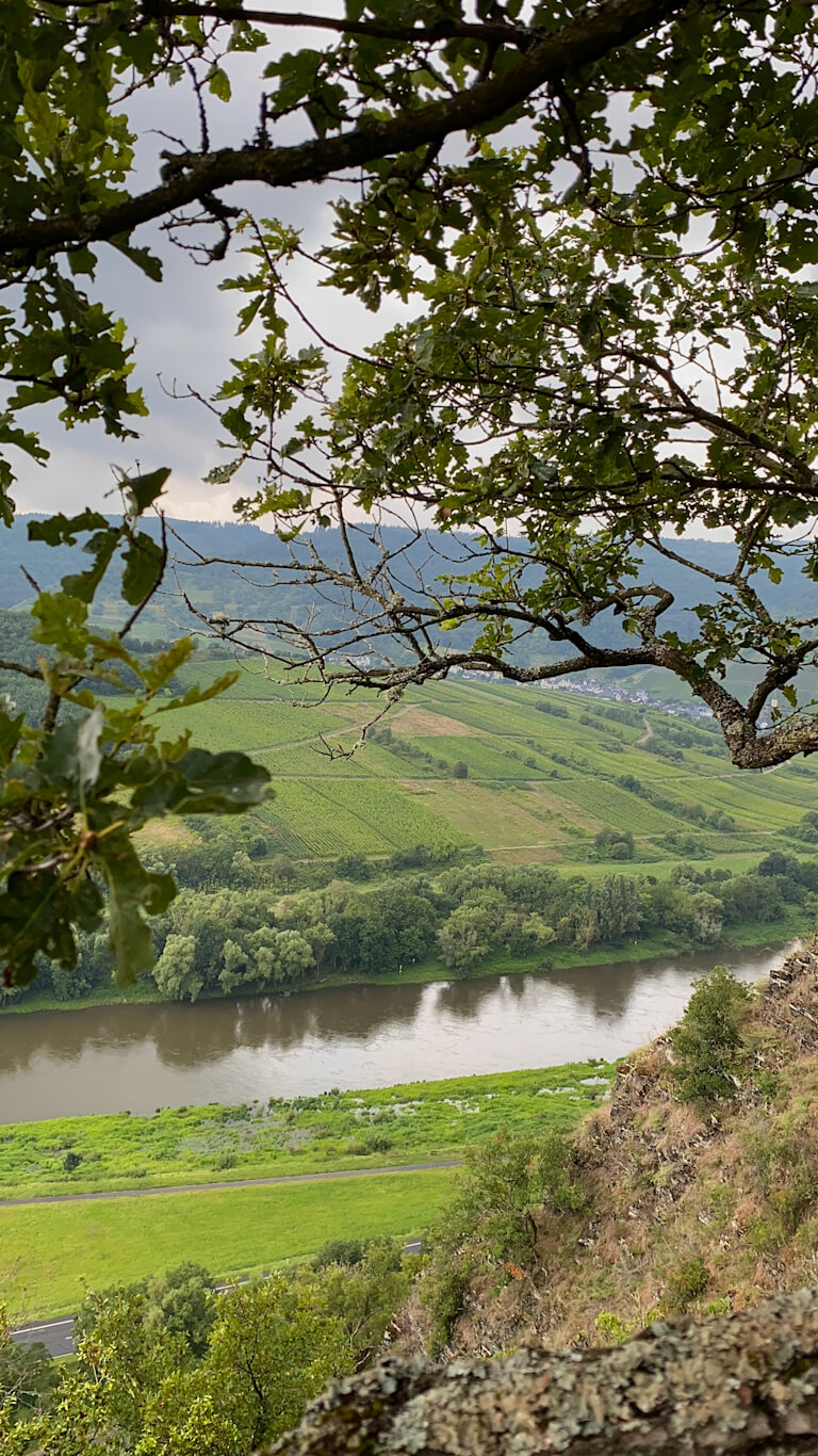
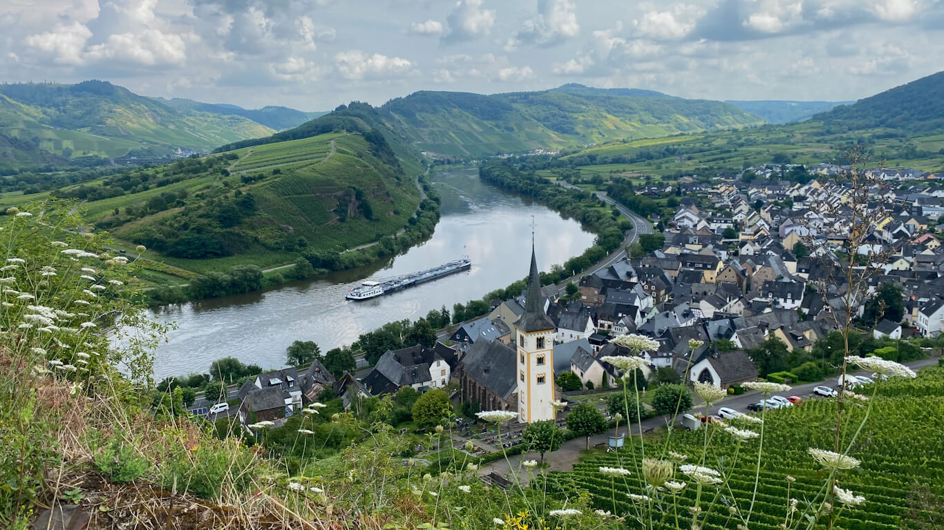
Your first viewpoint will be Eller Todesangst. This place has a calming view of the Moselle River, the beautiful houses of the town, and a train track across the river where you might catch a glimpse of a passing train. It is a beautiful view, something that can surely remind you of what you’re missing if you’re not that outdoorsy.
As you enjoy the beautiful scenery and make a promise to hike more often, your hike will start to take shape. The ascents will gradually become steeper, and the trail will turn rugged. In another 15-20 minutes, you will reach your second viewpoint.
Second Viewpoint: Aussichtpunkt Ediger-Eller
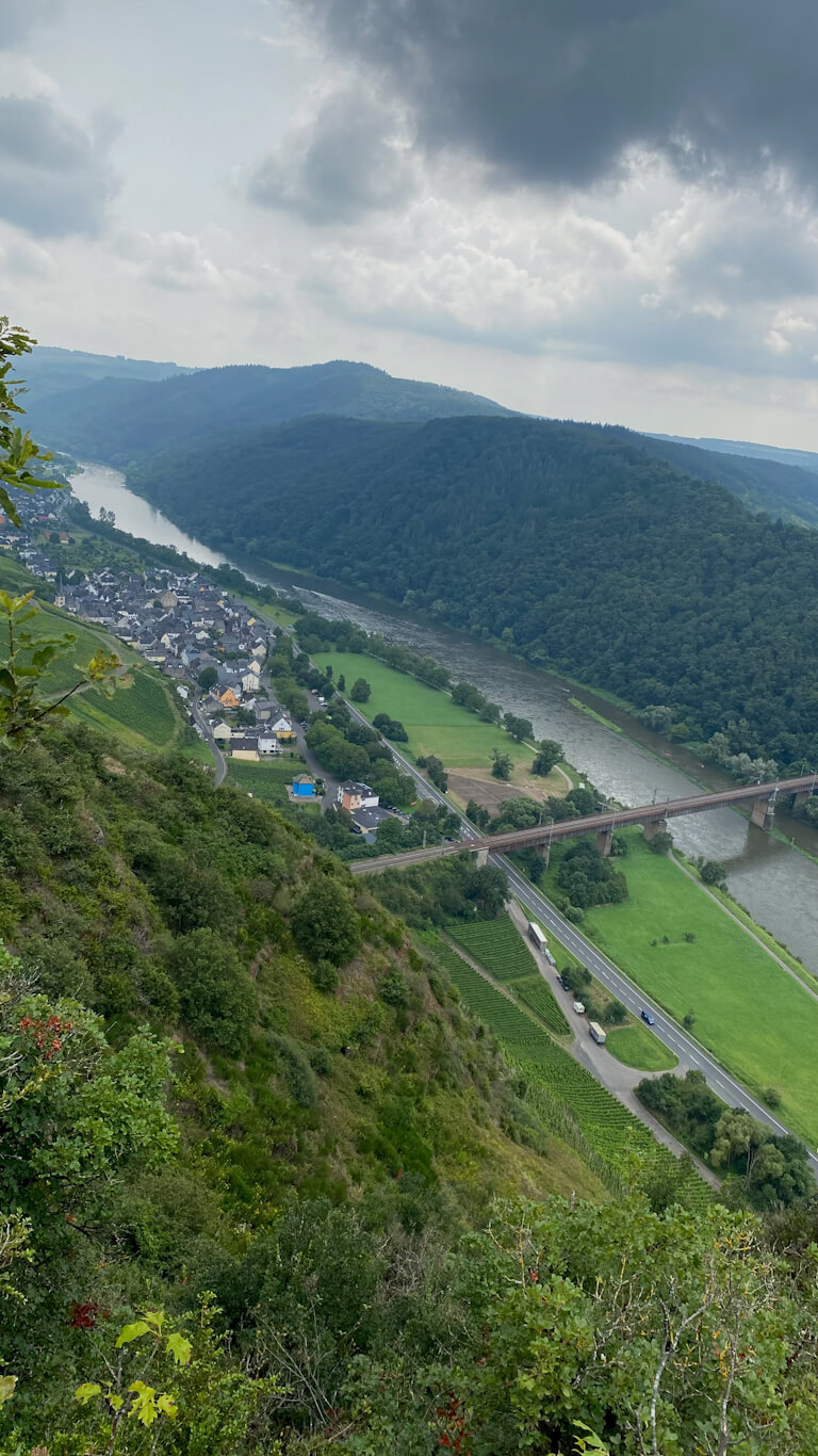
Aussichtspunkt Ediger-Eller will be your second viewpoint, offering incredibly beautiful views. There’s a small hut where you can rest and enjoy a few snacks and drinks while taking in the scenery. During our hike, the hut was packed with people. From this point, you’ll have a clear view of Ediger-Eller town and start to see where the Mosel River bends and flows around the other side of the hill.
It’s important to note that there is also a Klettersteig (via ferrata) route to Bremmer Calmont. Unless you’re specifically visiting for the Calmont Klettersteig, we do not recommend taking that route, as it can be quite dangerous if you’re not properly prepared. By following the Google Maps trail mentioned earlier, you’ll avoid this challenging route.
From Aussichtspunkt Ediger-Eller, you’ll continue your hike along a forested, smooth but slightly steep trail. Along the way, you’ll come across a reconstructed Roman Mountain Sanctuary. Taking some time to explore the temple complex and its surroundings can be a nice addition to this short hike to Bremmer Calmont.
Bremmer Gipfelkreuz
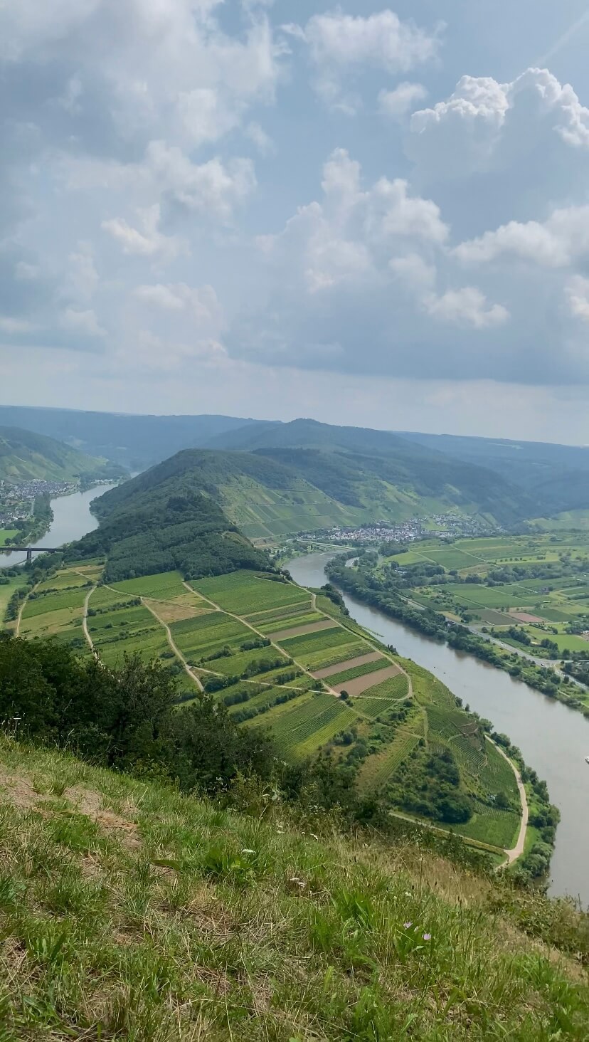
Only 10 minutes of smooth hiking from the Roman Mountain Sanctuary will bring you to Bremmer Gipfelkreuz. This beautiful hilltop offers one of the most stunning views of the Mosel River. From Bremmer Gipfelkreuz, you’ll be treated to a breathtaking view of the river as it curves around a hill, creating a picturesque horseshoe bend.
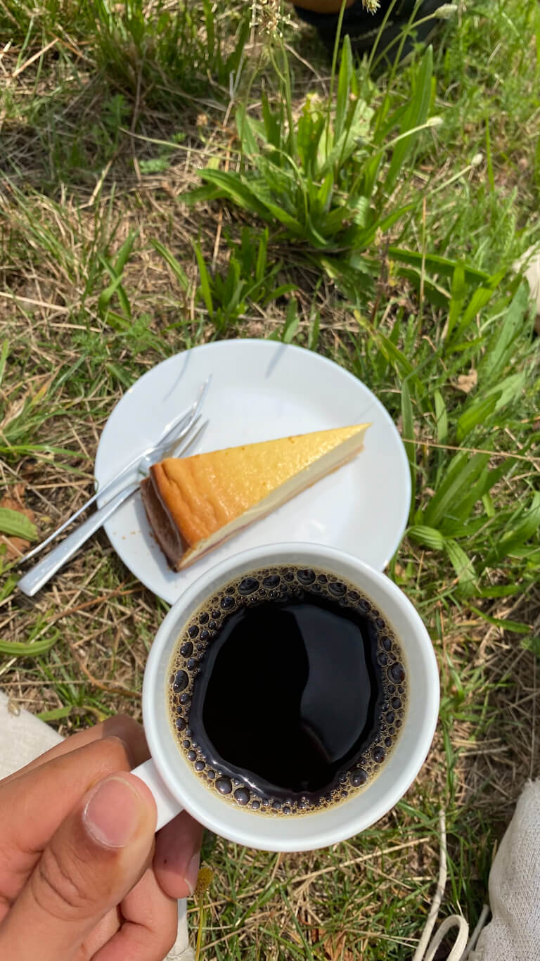
At Bremmer Gipfelkreuz, there is a small stall (Weinschänke am Gipfelkreuz) where you can enjoy regional wines, beers, coffees, and cakes. We enjoyed a cup of coffee and a slice of cake for 5.5 EUR while marveling at the beautiful scenery in front of us.
Aussichtspunkt Calmont
Only a few minutes of hike from Bremmer Gipfelkreuz will take you to Aussichtspunkt Calmont, where you can enjoy the best view of the horseshoe bend. The descent is quite steep, so it’s advisable to be extremely careful. There is a small observation deck that can accommodate maybe a maximum of 5 people. This viewpoint is also labeled as “Aussichtspunkt Calmont” on Google Maps.
After taking in the stunning views, we began our descent to the tiny town of Bremm. After hiking for another 20-25 minutes, we reached the gravel roads and caught a glimpse of the town below us.
When we were almost close to the town, we also found a gravel road that turned left and promised us a much more clear view of the horse-shoe bend. Without hesitation, we hiked towards it.
We hiked for about 5-10 minutes along the vineyard until we reached a point where we could clearly see the horseshoe bend along the Mosel River. Although the view wasn’t as elevated as from Aussichtspunkt Calmont, it still provided a clear observation of the Mosel River’s horseshoe bend. We also got a closer look at the monastery ruins of KlosterRuine Stuben and the town of Bremm to our right.
Afterward, we made our way down to Bremm and explored the tiny streets of this charming town; this hike just kept giving till the very end. From Bremm, we took the 710 bus back to Ediger-Eller and then caught the RB 81 train for our journey back to Koblenz.

When is a Good Time to Hike Bremmer Calmont?
Hiking to Bremmer Calmont is possible in all kinds of weather, though it can be a bit challenging in winter due to the cold and the possibility of snow. It’s always advisable to wear proper hiking shoes and gear that are suitable for the weather conditions.
However, the best time to hike Bremmer Calmont is during the spring, summer, and autumn seasons. Essentially, the months from April to October are ideal for this hike. On sunny days, the hike offers even more stunning views and experiences.
Don’t forget, the Mosel Valley is exceptionally beautiful during the autumn season. If you plan your visit in October or November, be prepared to receive a colorful welcome as the landscape transforms with vibrant autumn hues.
Frequently Asked Questions About Bremmer Calmont
Q. Is it also possible to view the horseshoe bend of the Mosel without hiking?
Yes, it is possible to reach the viewpoint without hiking. You can take bus 710 to Bremm and walk for 20 minutes or so and still enjoy a beautiful view from this viewpoint.
If you are driving, you can also drive further through the hills to get closer to the main viewpoint. You can park your car at this designated parking spot nearby. It is important to note that Google Maps might give you terrible directions once you start driving through the hill. Try to follow the map rather than completely relying on their directions as that can go terribly wrong sometimes and might take you to a different road.